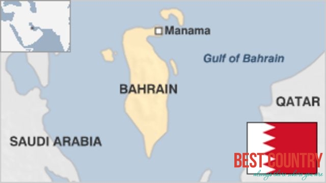
Geography of Bahrain
It consists of a low desert plain rising gently to a low central escarpment with the highest point the 134 m (440 ft) Mountain of Smoke (Jabal ad Dukhan). Bahrain has a total area of 665 km2 (257 sq mi), which is slightly larger than the Isle of Man, though it is smaller than the nearby King Fahd International Airport near Dammam, Saudi Arabia (780 km2 (301 sq mi)).
As an archipelago of thirty-three islands, Bahrain does not share a land boundary with another country but does have a 161 km (100 mi) coastline. The country also claims a further 22 km (12 nmi) of territorial sea and a 44 km (24 nmi) contiguous zone. Bahrain's largest islands are Bahrain Island, Muharraq Island, Umm an Nasan, and Sitrah. Bahrain has mild winters and very hot, humid summers. The country's natural resources include large quantities of oil and natural gas as well as fish in the offshore waters. Arable land constitutes only 2.82% of the total area.
92% of Bahrain is desert with periodic droughts and dust storms the main natural hazards for Bahrainis. Environmental issues facing Bahrain include desertification resulting from the degradation of limited arable land, coastal degradation (damage to coastlines, coral reefs, and sea vegetation) resulting from oil spills and other discharges from large tankers, oil refineries, distribution stations, and illegal land reclamation at places such as Tubli Bay. The agricultural and domestic sectors' over-utilization of the Dammam Aquifer, the principal aquifer in Bahrain, has led to its salinization by adjacent brackish and saline water bodies.