Geography of Afghanistan
Borders
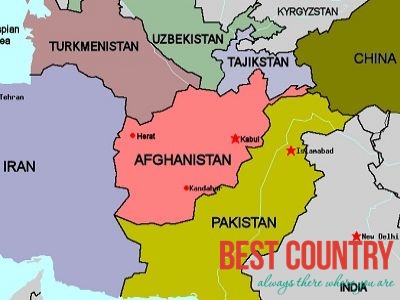
Afghanistan has a total of 5529 km of borders - the longest part of the border (2,430km) is known as the Durand Line and forms Afghanistan international border with the Islamic Republic of Pakistan.
It is in the south and southeast of Afghanistan. The border with Iran, which is to the west of Afghanistan, is 936km.
To the north are the Central Asian countries - Tajikistan has a border of 1,206km with Afghanistan), Turkmenistan has 744km, and Uzbekistan has 137 km.
Afghanistan also has border with China, it is 76km in length and is located in the far north-east of the country, although this is disputed by both Pakistan and Tajikistan which lay irredentist claims on Wakhan area.
Land
Afghanistan has a lot of rugged mountains known as the Hindu Kush as well areas of desert.
Highest and lowest
Lowest point: Amu Darya 258 m
Highest point: Noshaq 7,492 m
Natural hazards
Damaging earthquakes occur in the Hindu Kush mountains; flooding and droughts in the south and south-west of the country.
Natural resources
Afghanistan's natural resources include: natural gas, petroleum, coal, copper, uranium, gold, silver, chromite, talc, barites, sulfur, lead, zinc, iron ore, salt, precious and semiprecious stones.
Mountain systems
Mountains in Afghanistan
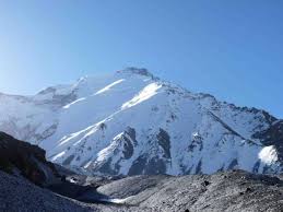 The Hindu Kush reaches a height of 7485 m. / 24,557 ft. at Nowshak, Afghanistan's highest peak.
Of the ranges extending southwestward from the Hindu Kush, the Koh-i-Baba reaches the greatest height (Shah Fuladi, 5,142 m /16,870 ft).
The Safed Koh range, which includes the Tora Bora area, dominates the border area southeast of Kabul.
The area towards the Khyber Pass across the Safed Koh are in eastern Afghanistan; at the top the height is 1070 m. / 3,509 ft. at Landi Kotal.
This area is near to Pakistan, the town of Torkham is five kilometres from Pakistan.