Geography of São Tomé and Príncipe
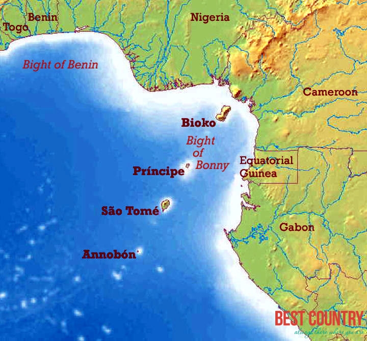
São Tomé and Príncipe constitute one of Africa's smallest countries, with 209 km (130 mi) of coastline. Both are part of an extinct volcanic mountain range, which also includes the island of Bioko in Equatorial Guinea to the northeast and Mount Cameroon on the mainland coast further northeast. São Tomé is 50 km (30 mi) long and 30 km (20 mi) wide and the more mountainous of the two islands. Its peaks reach 2,024 m (6,640 ft) - Pico de São Tomé. Principe is about 30 km (19 mi) long and 6 km (4 mi) wide, making it the smaller of the two. Its peaks reach 948 m (3,110 ft) - Pico de Príncipe. This makes the total land area of the country 1,001 km2 (386 sq mi), about five times the size of Washington, D.C. Both islands are crossed by swift streams radiating down the mountains through lush forest and cropland to the sea. Both islands at a distance of 150 km2 (60 sq mi). The equator lies immediately south of São Tomé Island, passing through an islet Ilhéu das Rolas.
The Pico Cão Grande (Great Dog Peak) is a landmark volcanic plug peak, located at 0°7′0″N 6°34′00″E in southern São Tomé. It rises dramatically over 300 m (1,000 ft) above the surrounding terrain and the summit is 663 m (2,175 ft) above sea level.