Anguilla
Geography of Anguilla
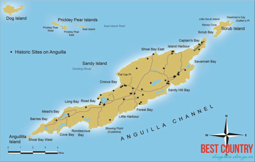
Anguilla is an island in the Leeward Islands, which lies between the Caribbean Sea in the west and the open Atlantic Ocean in the east. It is a long, flat, dry/wet, scrub-covered coral island, south and east of Puerto Rico and north of the Windward chain. One of the Renaissance Islands, it is separated from the British Virgin Islands by the Anegada Passage. The island has no significant elevations with its terrain consisting entirely of beaches, dunes, and low limestone bluffs.
Geography of Anguilla
Anguilla is an island in the Leeward Islands, which lies between the Caribbean Sea in the west and the open Atlantic Ocean in the east. It is a long, flat, dry/wet, scrub-covered coral island, south and east of Puerto Rico and north of the Windward chain. One of the Renaissance Islands, it is separated from the British Virgin Islands by the Anegada Passage. The island has no significant elevations with its terrain consisting entirely of beaches, dunes, and low limestone bluffs.

Overview of Anguilla
Anguilla is a British overseas territory in the Caribbean, one of the most northerly of the Leeward Islands in the Lesser Antilles. It consists of the main island of Anguilla itself, together with a number of much smaller islands and cays with no permanent population. It lies east of Puerto Rico and the Virgin Islands and directly north of Saint Martin.